Gravity Center
 |
| Gravity Center |
1. Open the application ILWIS 3.3 Academic
2. Open catchment in raster map
3. Right click on the catchment> vectorize> Raster-to-point ...
4. Fill output catchment_point> show> OK
5. Constituent picture will emerge with the points very much
6. Open the tab catchment_point point folder> right click and select Open as table
7. Click View> command line, to bring up the command line
8. Type X = CRDX (Coordinate)> OK
9. Will munucul new column that contains X
10. Type Y = CRDy (Coordinate)> OK
11. Click on view> statistics Pane
12. Back to the main window and then click File> create> Table
13. fill in the name of the table with G_Center> Record: 1> OK
14. add columns by clicking Columns> add column
15. Fill in the name of the column with X> OK
16. Add a column and named Y
17. Back to the table and then copy cathment_point Average X by right click> copy or CTRL C
18. And paste it into the table G_Center in column X
19. Do it again on the Y, Y Average copy and paste the table into catchment_point Y column in the table G_Center
20. Go to the main window and then click the folder table located above the command line and right click on G_Center> Table Operations> table to PointMap ...
21. Select the Coordinate System UTM_WGS1984
22. Enter the G_Center Output> Show> OK
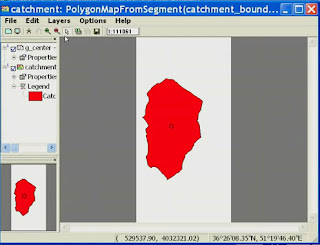
23. Open the file Catchment Polygon map> add layer by clicking the Add layer and add G_Center
24. The result will be the mid-point of the polygon catchment is on the screen
For more details see the following video tutorial
or can be downloaded here
DOWNLOAD


0 komentar:
Posting Komentar